
Every San Antonio foundation repair starts with the ground under the house, and in San Antonio that ground changes across the city. The far north sits on thin soil over Hill Country limestone, the central belt on deep expansive Blackland clay, and the south on sandy soil over clay.
The soil, plasticity index, and foundation type change from one neighborhood to the next. See what’s under your ZIP and what a repair usually takes.
Overview
- Dominant soil: Deep expansive Blackland clay through the central belt, thin soil over limestone to the north, sandy-over-clay to the south
- Annual rainfall (1991–2020): 32.4″ — seasonal swing 2.7″
- Monthly swing: 4.4″ → 1.7″ (May vs February)
San Antonio Foundation Repair by ZIP
San Antonio Soil Types
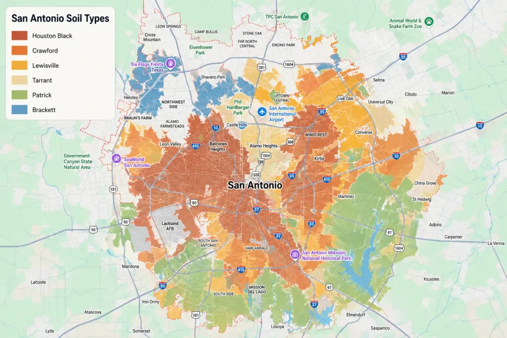
San Antonio actually sits on three different kinds of ground, and which one is under your home depends on where in the city you live.
The far north is Hill Country, thin soil over limestone. The broad central belt is Blackland Prairie, deep expansive clay. The far south is a sandy soil over clay. Here's what's under your neighborhood, from the most reactive clay to the mildest ground:
- Houston Black - The Texas state soil and the main cause of foundation trouble in Bexar County. A deep expansive clay ("black gumbo") across the central belt that swells and shrinks hard with the seasons. Common on the west, southwest, and southeast sides.
- Crawford - A clayey soil over limestone in the transition zone north of the clay belt. Deeper than the Hill Country soils and moderately to highly reactive. Found on the northeast side.
- Lewisville - A silty clay on the older central-city terraces. Moderately reactive. Common around Alamo Heights and Terrell Hills.
- Tarrant - Up north the story flips: Tarrant is a very shallow, rocky clay sitting right on limestone. The clay reacts, but there's little of it before you hit rock, so movement is smaller and more about the bedrock. Common in Stone Oak.
- Patrick - On the south terraces, a gravelly loam over caliche. Lower movement than the central clay. Typical of the far south side.
- Brackett - A shallow loamy soil over fractured limestone on the steep north slopes. Low clay means little swelling, but the soil is thin, so foundations rest close to rock. Common in Helotes and the far north.
Why Do San Antonio Foundations Move?
The reason San Antonio foundation repair is so common comes down to what's beneath the slab, and in San Antonio, that changes as you move across the city.
Through the central belt, the west, southwest, and southeast sides, homes rest on the Blackland Prairie: deep smectitic clay like Houston Black (the official Texas state soil), with a plasticity index around ~35–50 and very high shrink-swell potential. This clay swells when wet and contracts when dry, pushing on foundations year after year.
Up north, toward Stone Oak and the Hill Country, the Edwards Plateau takes over. Soils like Tarrant and Brackett are thin and sit directly on limestone. There's far less clay to move, so the problem shifts from expansion to shallow bearing and drainage off the rock. To the south, sandy soils over clay move less than the central belt but still shift with moisture.
What is PI (Plasticity Index)?
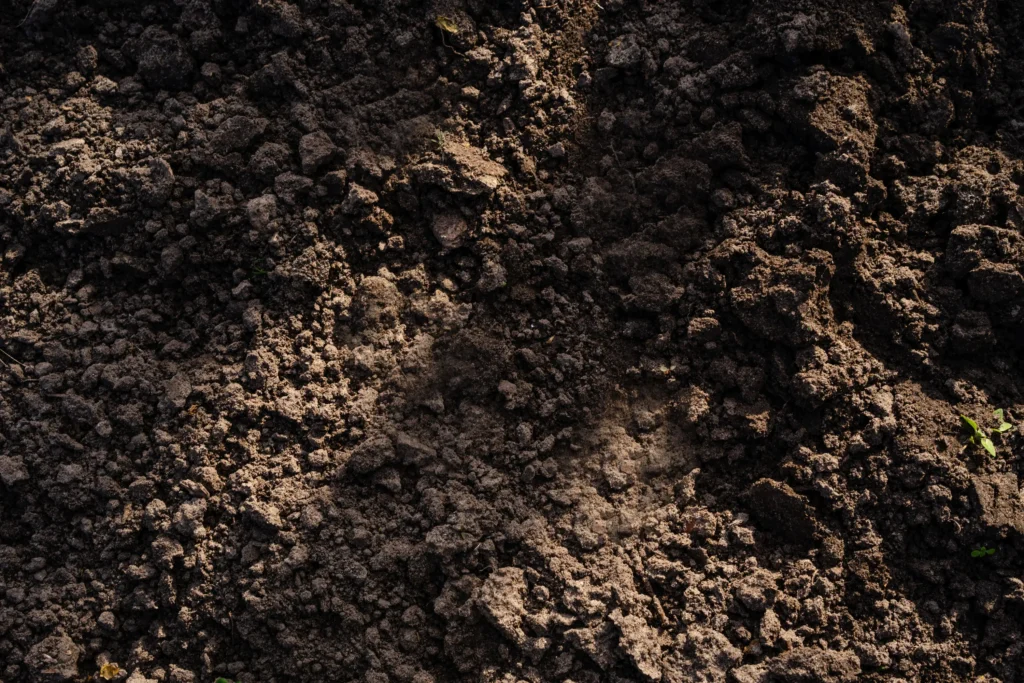
PI is a measure of how much a soil moves with moisture, the higher the number, the more it swells when wet and shrinks when dry.
Anything above 35 is considered very reactive, which is why San Antonio's central Houston Black clay (PI ~35–50) gives foundations the most trouble, while the northern limestone soils (PI ~10–20) move far less.
San Antonio averages about 32.4" of rain a year, drier than Austin or Waco, but it still arrives unevenly: roughly 4.4" in May against 1.7" in February. That 2.7" seasonal swing is enough to cycle the clay and, over time, work against the foundation.
Need San Antonio Foundation Repair?
Free, no-obligation inspection from a local G.L. Hunt specialist. · Call Now!
Not in San Antonio? We break down texas soil and foundation risk by neighborhood in Waco and Austin too.
San Antonio Foundation Repair FAQ
Why do foundations move in San Antonio?
It depends where in Bexar County you are. The central belt sits on deep expansive clay that swells and shrinks with rain. The far north is thin soil over limestone; the south is sandy over clay. The clay belt moves most.
Which San Antonio neighborhoods have the worst soil for foundations?
The central Blackland belt. West, southwest, and southeast neighborhoods on Houston Black clay have very high shrink-swell potential. Far-north Hill Country areas like Stone Oak and Helotes sit on thinner, less reactive soils over limestone.
Are homes in San Antonio slab or pier-and-beam?
It depends on the age of the neighborhood. Older inner areas like Alamo Heights and the Deco District have many pre-1960 pier-and-beam homes. Newer suburbs are almost all slab. Slabs on clay are repaired with piers; pier-and-beam homes are re-leveled.
Note: The per-ZIP series assignments follow the three-zone geography and are directionally correct, but a few central-city ZIPs sit near zone boundaries where soil varies, worth a spot-check against Web Soil Survey, especially 78247 and 78209.
Sources: USDA-NRCS Official Series Descriptions & KSSL lab data (via UC Davis SoilWeb); NOAA 1991–2020 rainfall normals for San Antonio International Airport. Soil series is characteristic per the Bexar County soil survey and the city's three soil zones, not a parcel-level measurement; foundation type is by neighborhood construction era.